Notice: Function _load_textdomain_just_in_time was called incorrectly. Translation loading for the news-vibrant domain was triggered too early. This is usually an indicator for some code in the plugin or theme running too early. Translations should be loaded at the init action or later. Please see Debugging in WordPress for more information. (This message was added in version 6.7.0.) in /home/fevluug2ormp3a1f/public_html/wpt.hvhappens.com/wp-includes/functions.php on line 6170

Warning: Cannot modify header information - headers already sent by (output started at /home/fevluug2ormp3a1f/public_html/wpt.hvhappens.com/wp-includes/functions.php:6170) in /home/fevluug2ormp3a1f/public_html/wpt.hvhappens.com/wp-includes/feed-rss2.php on line 8
Hurricane Beryl prediction – Huntsville Happens https://wpt.hvhappens.com Where News Happens for Huntsville, TX Sun, 07 Jul 2024 21:59:28 +0000 en-US hourly 1 https://wordpress.org/?v=7.0.3 New Course Places Beryl on Path to Impact Huntsville https://wpt.hvhappens.com/index.php/2024/07/07/new-course-places-beryl-on-path-to-impact-huntsville/ Sun, 07 Jul 2024 16:51:09 +0000 https://hvhappens.com/?p=222

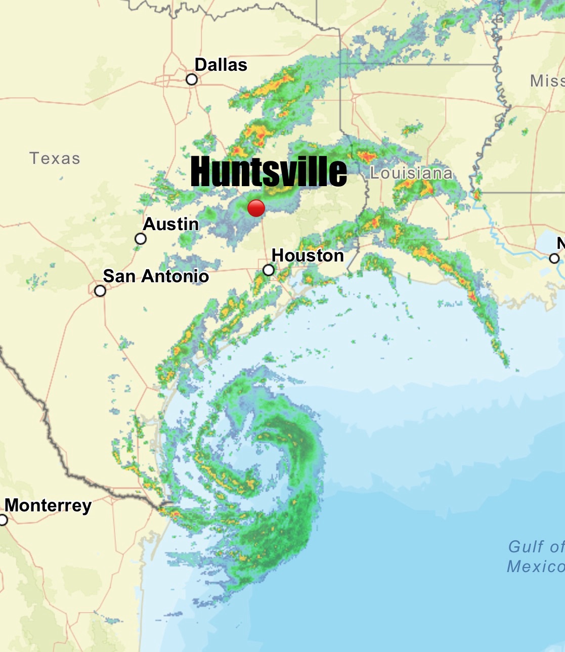
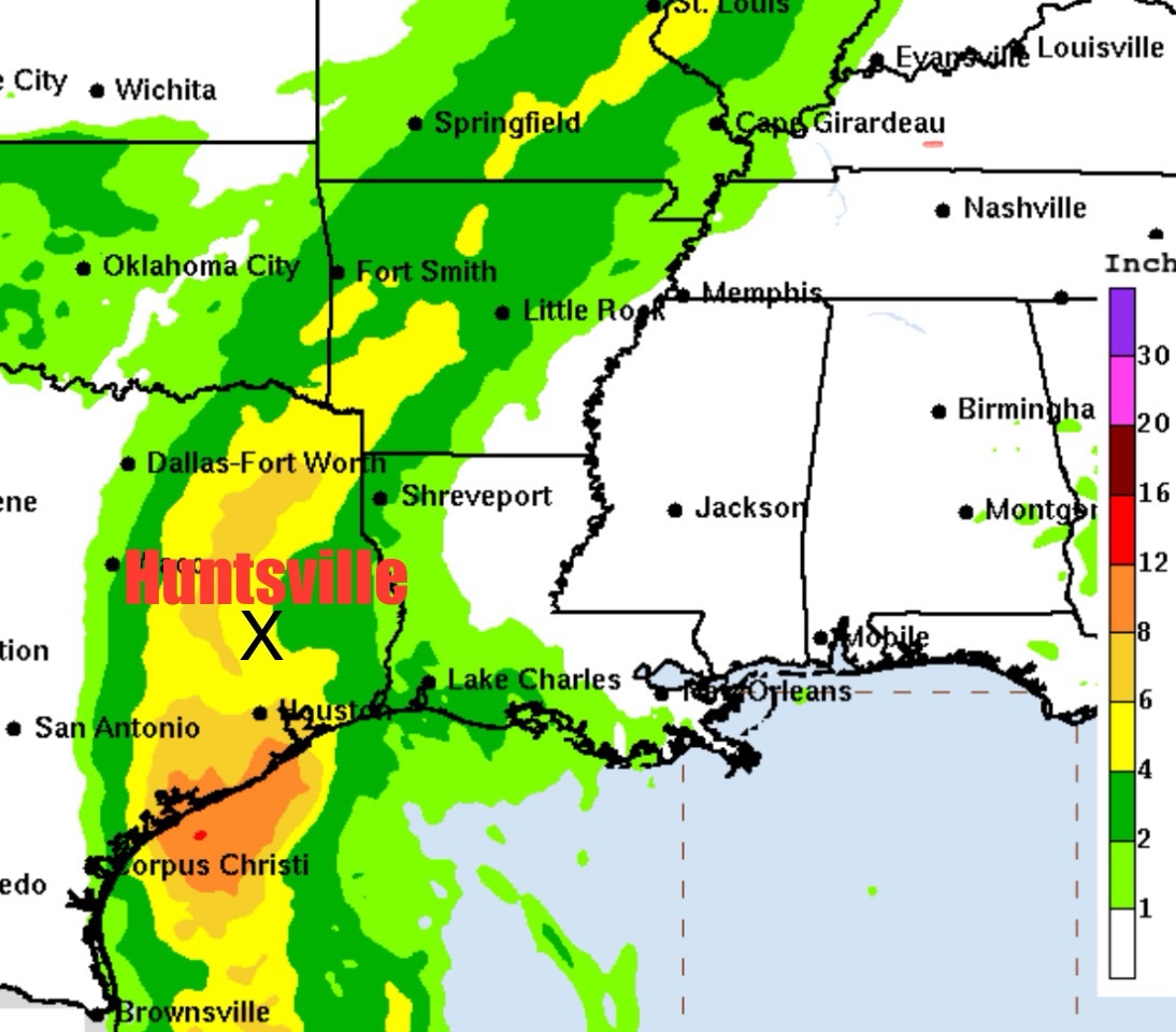
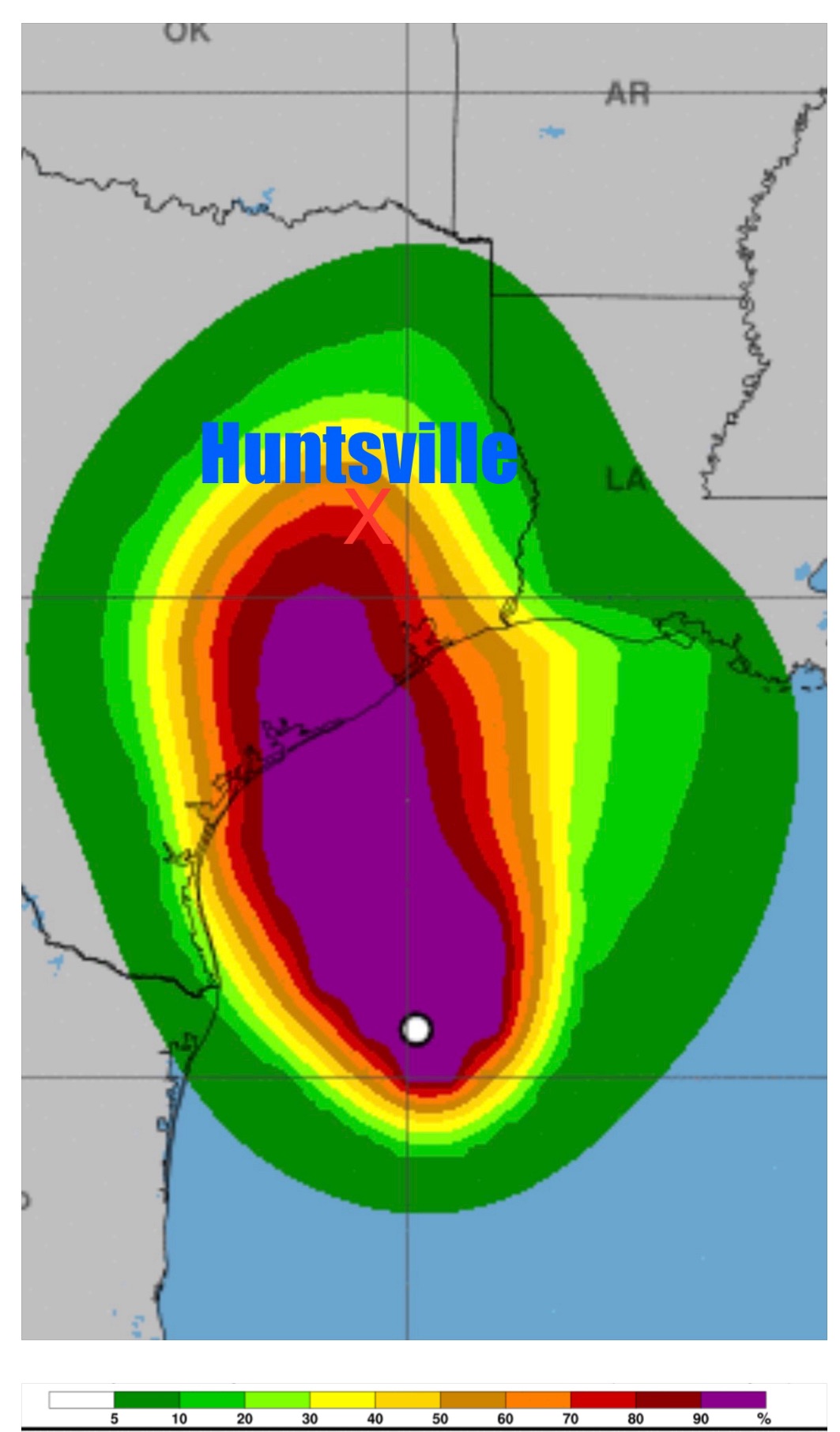
The National Hurricane Center now predicts the eye of Beryl to pass near Huntsville. The Huntsville Area is predicted to receive the dirty side of the storm which is expected to be upgraded soon.

Huntsville area residents should secure all outside items to prevent flying debris and projectiles. Beryl shifts course closer to Huntsville. The Huntsville area can expect sustained winds of 39 to 73 mph. Wind gust of 80-90 MPH may occur, dangerous lightning, and the risk of tornadoes. This storm may produce tornadoes, dangerous lightning, and life threatening flash floods for our area.
]]>
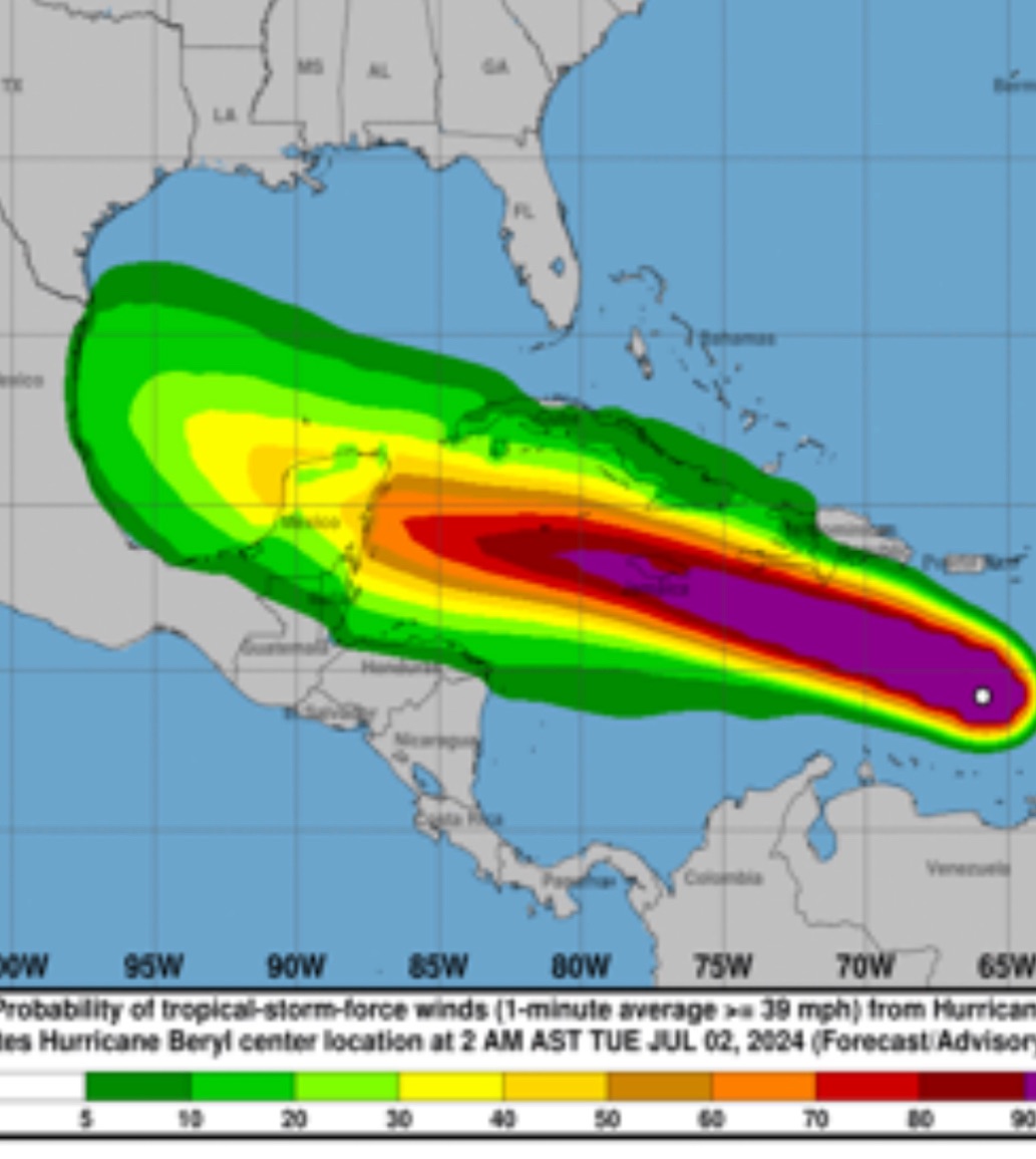
Hurricane Beryl Upgraded to Category 5 Hurricane https://wpt.hvhappens.com/index.php/2024/07/02/hurricane-beryl-upgraded-to-category-5-hurricane/ Tue, 02 Jul 2024 10:28:57 +0000 https://hvhappens.com/?p=176 Hurricane Beryl is tracking West / Northwest towards the Yucatán Peninsula and is expected to enter into the Gulf of Mexico by Friday.

The storm is now a dangerous Category 5 Hurricane with sustained wind of over 150 MPH.

The latest storm models show the storm making landfall along the Northern Gulf Coast of Mexico and South Texas after crossing the Yucatan Peninsula. 
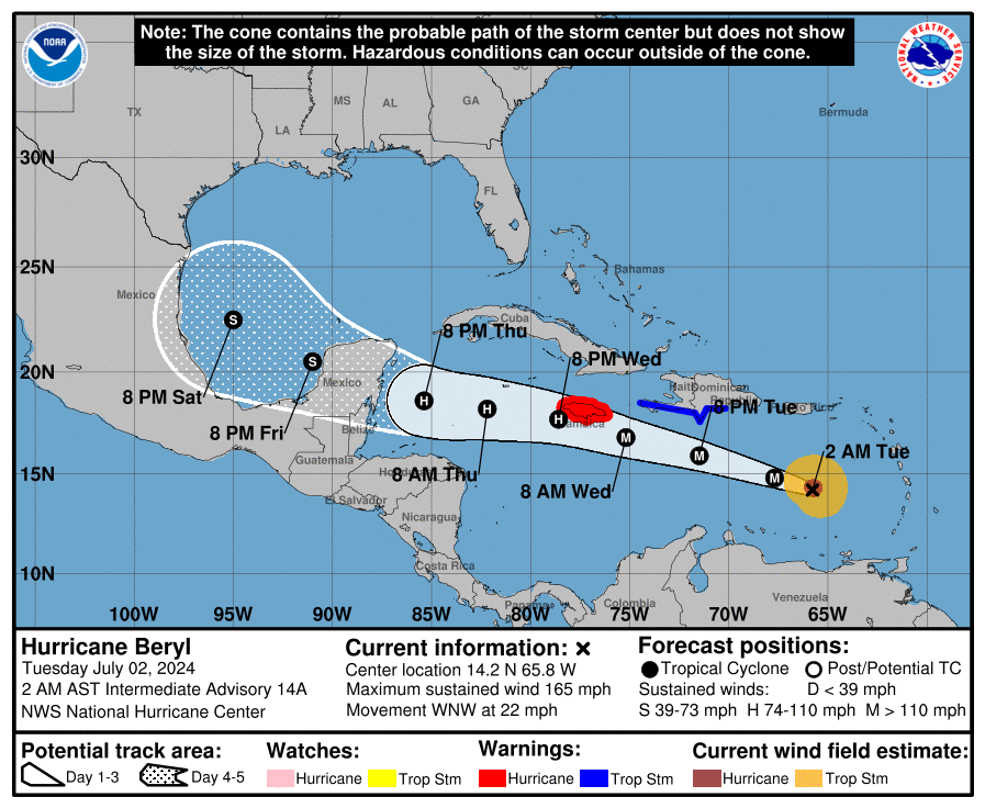
A weakening high pressure in the Gulf could change these models by this weekend. Stay updated as storm predictions are rapidly changing.
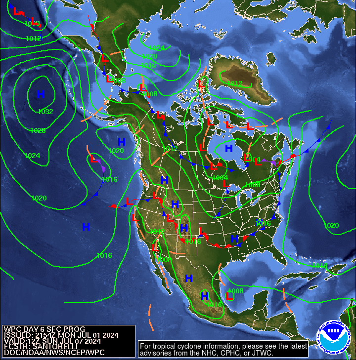
6 day pressure forecast
]]>